(Commemorative info for Araw ng Kagitingan) Researched/Edited/Compiled By: Dindo Mojica, C.E., M.Eng Source: History of Maragondon by Dr. Enjoe Z. Nigoza
"My late grandfather (Epifanio Fello, a USAFFE soldier/WW II veteran) once told me the story of the invasion of the Japanese forces here in Maragondon. Sometimes in 1939,1940, the Japanese came to Maragondon, Ternate and Naic as "tourists". These "tourists" were intels of the Japanese Imperial Armed Forces on that time. They were top-notch surveyors and engineers who made their special surveys of the mountains of Maragondon and Ternate through photographs. They calculated on how bombs/missiles will reach their destination: the Corregidor Island. How fascinating... I can't believe my granpa told me this story... But it is true that the last defense of the combined Filipino and American Armed Forces were in Corregidor Island, which later on they surrendered to the Japanese."
Maragondon had its part during the Second World War. The Japanese forces in 1942, built a garrison in the area so the people were in a night mare and in cohorts of fear. But for the safeguard and to depend the inhabitants from the maltreatment of the Japanese, the “Gerilla Talinos” unit was organized on June 13, 1942 by Capitan Catalino del Rosario and through the support of Mariano Villanueva, Patrocinio Gulapa, Col. Francisco Punzalan, Vicente Somoza, Alfredo Velando and others. The Guerilla Liberato’s unit was also organized.
With the emergence of many Guerillas unit in Maragondon, the Japanese made a sudden attack in the area. All men were arrested and put to jail at Maragondon Elementary School for seven days.
On February 3, 1945, Capitan Catalino Del Rosario and his men ambushed the Japanese who were having a patrol. So then, that was the signal of the massive fighting of the Gerillas and the Japanese forces.
In a month of struggle, at long last, Maragondon and the people gloriously surpassed the war because the Japanese forces were taken out of the place and also because of the brave tactics of the Guerillas and the all-out support of the American soldiers.
THE VFP-MARAGONDON CHAPTER MARKER (BUCAL 4)
(Location: Near Bucal 4 Elementary School,
Maragondon Water District Bucal 4 Pumping Station, and St. Anthony Bucal 4 Chapel)
During World War II, Maragondon youths were among those called to the colors. They fought in Bataan and Corregidor among other places. The survivors, upon return, helped organize and joined an underground force, Maragondon own liberators, the Guerillas, continue their resistance against the Japanese invaders. The unit joined the returning American forces in liberating Cavite, Quezon, and Batangas provinces. A significant event during World War II against the Japanese invaders was the annihilation of one group of enemy soldiers at Barrio Bucal 4 up to the ricefields of Malainen Luma, Naic which led to the sona. Those guerrilla soldiers were the Guerilla Hunters ROTC unit and Taparan’s Unit who fought the thousands of Japanese forces on February 3-6, 1945. This ambush was led by Captain Hunter Catalino del Rosario of Bucal 4 under the leadership of Col. Emmanuel V. de Ocampo, Commander of the 47th and 48th Regiment of Hunters ROTC squad.
Blast from the Past: Searching for Bonifacio's Bones
Guillermo Masangkay
In 1918, the American-sponsored government of the Philippines mounted a search for Bonifacio’s remains in Maragondon. A group consisting of government officials, former rebels, and a man reputed to be Bonifacio’s servant found bones which they claimed were Bonifacio’s in a sugarcane field on March 17. The bones were placed in an urn and put into the care of the National Library of the Philippines. They were housed at the Library’s headquarters in the Legislative Building in Ermita, Manila, together with some of Bonifacio’s papers and personal belongings. The authenticity of the bones was much disputed at the time and has been challenged as late as 2001 by Ambeth Ocampo. When Emilio Aguinaldo ran for President of the Commonwealth of the Philippines in 1935, his opponent Manuel L. Quezón (the eventual victor) invoked the memory of Bonifacio against him, the bones being the result of Bonifacio’s execution at Aguinaldo’s hands. During World War II, the Philippines was invaded by Japan in 1941. The bones were lost due to the widespread destruction and looting during the Allied capture of Manila in February 1945.
Phase I - it includes the installation of the 12 ft bronze statue of Gat Andres Bonifacio and Procopio Bonifacio, KKK Sculptural Wall Relief, Shrine Platform and Plaza
Phase II - it includes the site-development for tourism purposes: construction of tourism information center, water supply system, driveway and parking area
Phase III - it includes the construction of overflow and footbridges, powerhouse, swimming pools (main and kids), concreting of pathways, landscaping, park lighting and luminaries.
It was completed before May 10, 2008
Source: Maragondon Chronicle Volume 1 Number 1 October - December 2007
There is no available public transportation going to the site. As of now, there are earth roads connecting from the Barangay Pinagsanhan (Ibayo) proper going to the site. So it is advisable to use private vehicles (specially SUV's and Jeeps) most especially in dry months. Hiking is also advisable going to the site.
Tourists/hikers are advised to coordinate with the local guides at the Local Government Unit of Maragondon, Cavite before going to the site.
The start of our journey
Going to Bonifacio Park (from Sapang, Ternate, Cavite just turn left)
From Barangay Pinagsanhan-B, Maragondon, Cavite,
just turn right going to Bonifacio Park
Barangay Pinagsanhan Earth Road (Junction)
The long, rough and rugged earth road...
Mt. Malikaban, at the background
the Overflowing Bridge in Pinagsanhan River
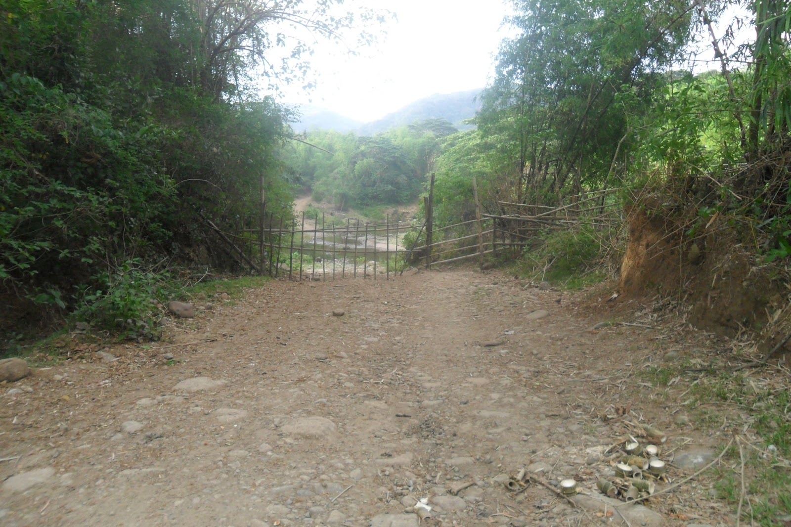
There is a bamboo gate across a dirt road that leads to the shrine built in Cavite in honor of Andres Bonifacio.
It is a primitive gate – the type where you have to pull out one by one the bamboo stems laid horizontally so the gate will swing open.
The gate is a short drive from a grassy clearing that I thought was the end of the road. There's a man outside a hut who told us to make sure we keep the gate closed or else the grazing cows and carabaos might wander out. So my father opened it (again) and closed the simple bamboo gates so that cattles and water buffaloes will not go out so far...
Mt. Malikaban, at the background
(I thought it was Mt. Hulog or Mt. Buntis,
Mt. Hulog is located at Mt. Malikaban's back)
Mount Malikaban, as the legend says that the goddess/fairy (diwata) lived in this mountain which her aim is to help the people in Maragondon by lending them things
We have taken the wrong path -
Oh no were lost! (naligaw kami!)
(Dead-End)
Pinagsanhan River
The water buffaloes (carabaos) on view
Mt. Malikaban, at the background
Mount Malikaban, as the legend says that the goddess/fairy (diwata) lived in this mountain which her aim is to help the people in Maragondon by lending them things
Going back to where we started...
There is another bamboo gate across a dirt road leads to the shrine built in Cavite in honor of Andres Bonifacio (second one).
It is also a primitive gate – the type where you have to pull out one by one the bamboo stems laid horizontally so the gate will swing open.
The gate is a short drive from a grassy clearing that I thought was the end of the road. There's a man outside a hut who told us to make sure we keep the gate closed or else the grazing cows and carabaos might wander out. So my father opened it (again) and closed the simple bamboo gates so that cattles and water buffaloes will not go out so far...
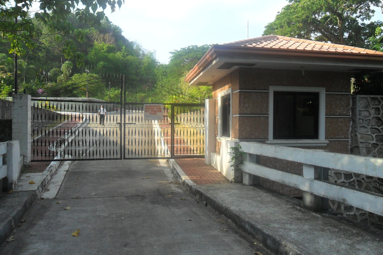
Yes, a concrete road at last!
We have just made it... Going to Bonifacio Park/Shrine
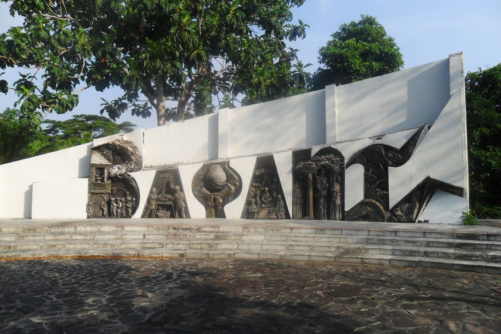
On the right side is the Gat Andres Bonifacio Memorial Shrine. With a garden-like landscape on both sides ornamented with flowers and foliage, plus the benches, a cobble-stoned walkway leads to the shrine platform and plaza. The marker of the shrine detailing Bonifacio’s heroism and death is fenced and marbled. Behind in it is the elevated shrine where the 12-foot (4m) bronze statue of the slain Bonifacio brothers, and the KKK and Bayani sculptural wall reliefs depicting the intrepid men and women of the Katipunan stand.
The National Historical Institute (NHI)
Marker and Monument
Supremo Gat Andres Bonifacio's Marker
("I'm still confuse on what date Hermano Supremo died...")
The NHI Marker says that:
Mt. Nagpatong, Maragondon, Cavite
Last May 10, 1897
on this place which called Nagpatong,
near Mount Buntis, Maragondon,
where the Brothers the Supremo, Andres Bonifacio
and Procopio Bonifacio was shot
according to decision of the Military Court
of the Revolutionary Government
or it should be translated to:
“by order of the military tribunal of the revolutionary government” (of Emilio Aguinaldo)
THE UPPER SIDE OF THE MONUMENT
(By Freemasons)
(Front View)
Note: My Spanish to English translation was not very good... :(
The brothers, Supremo Andres Bonifacio (left) and Procopio Bonifacio
Procopio Bonifacio
Hermano Gat Andres Bonifacio
Supremo Gat Andres Bonifacio A 4 meter (12 ft) bronze monument crafted by Sculptor Imao
THE PARK/SHRINE COMPLEX
The bridge going to Mount Nagpatong summit
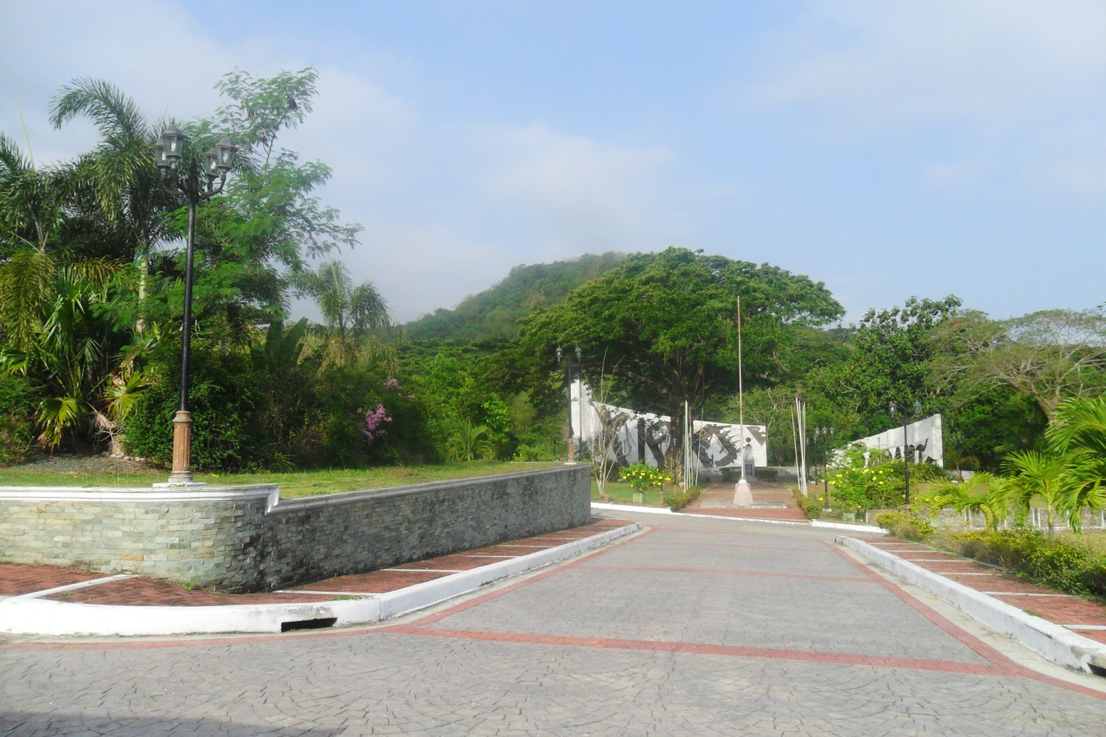
On the right side is the Gat Andres Bonifacio Memorial Shrine. With a garden-like landscape on both sides ornamented with flowers and foliage, plus the benches, a cobble-stoned walkway leads to the shrine platform and plaza. The marker of the shrine detailing Bonifacio’s heroism and death is fenced and marbled. Behind in it is the elevated shrine where the 12-foot (4m) bronze statue of the slain Bonifacio brothers, and the KKK and Bayani sculptural wall reliefs depicting the intrepid men and women of the Katipunan stand.
The ECO Pavilion (The Clubhouse)
Amid its verdant surroundings, there is a pavilion set at the left portion of the main entrance. Going inside is a spacious function hall that can accommodate 100 persons, a tourist information center, and a souvenir shop selling Maragondon bamboo-craft products.
(Front View)
Perspective
Rear View of ECO Pavilion
INSIDE THE ECO-PAVILION
Souvenir Shop
Souvenir Shop
THE SWIMMING POOL (ECO-PAVILION)
Swimming Pool
My Friends and Family
CLIMBING UP TO MOUNT NAGPATONG SUMMIT
My brother, Dennis starting to climb the Mt. Nagpatong summit
There are concrete pathways leading to campsites and picnic areas
Tatay Bene Milay at the Picnic Area
Now, were going to the summit of Mt. Nagpatong
At the summit
Going Down...
Mt. Malikaban, at the background
Mt. Hulog is located at Mt. Malikaban's rear.
Mount Malikaban, as the legend says that the goddess/fairy (diwata) lived in this mountain which her aim is to help the people in Maragondon by lending them things
It's time to go home...
Bamboos, Maragondon's exclusive product in the Province of Cavite
Traversing an Overflow Concrete Bridge at Pinagsanhan River
Taking Left turn going to Ternate, Cavite
(Right side going to Barangay Pinagsanhan Proper)
Boundary of Brgy. Pinagsanhan (Maragondon)
and Brgy. Sapang (Ternate)
Back to Sapang, Ternate, Cavite (Governor's Drive)