THE SCENERIES (Tourist Spots) in Maragondon, Cavite
THE SCENERIES (Tourist Spots) in Maragondon, Cavite
Places of InterestsAdopted by:
Dindo Mojica, C.E., M.Eng
Resident of Maragondon, Cavite
(note: curretly updating)

The town's welcome arch

Maragondon via Google Maps
How to Get There?
Via Public Transportation
By Bus: From Manila, you may take a bus ride from Southwest Integrated Terminal (former Uniwide Sales in Tambo, Paranaque) and look for the sign of Maragondon, Ternate or Naic routes via Cavite Expressway (Cavitex)
By Private Vehicles: From Manila, you may take the route of Cavite Coastal Road, then turn right going to Cavite Toll Expressway (Cavitex), straight to Kalayaan Diversion Road (Binakayan Interchange to Bacao, Gen. Trias), Antero Soriano Highway (Tanza to Naic) and straight ahed to Governor's Drive (to Maragondon).
Maragondon has historical sites that are still unknown to many. It has a rich cultural heritage that is a pride not only for the Cavite Province but for the country as well. The municipality refers basically to the many legendary and century-old houses and beautiful sceneries that surround the municipality. It has remnants of the 17th century structure that could showcase the significant role of the place in historical events of the past.
Maragondon is bounded by range or scenic mountains. Its panoramic view of the sleeping mountain noticeably attracts tourists and passersby. Presently termed as “Hiker’s Paradise”, Maragondon is often visited by mountain climbers, students and researchers who journey to experience the breeze of its mountain peak, Pico de Loro and the Mt. Palay-palay and Mataas na Gulod Protected Landscape which were proclaimed as such since 1975.
Maragondon as a tourist destination has many things to offer: the natural splendour of its scenic mountain ranges which can be seen from as far as Kawit and Bacoor on a clear day, the historic houses, sites and houses of worships, its local culture and rich folk traditions, rock formations and waterfalls, can all be found in this very fascinating town.
HISTORICAL SITES AND LANDMARKS
ANDRES BONIFACIO HERITAGE SITE
(Bonifacio Trial House and Execution Site)
ANDRES BONIFACIO TRIAL HOUSE
Andres Bonifacio Trial House is under the care and management of the National Historical Institute. The house belongs to Mr. Jose Angeles. A typical bahay na bato structure which was built in 1889. It was known as Roderico Reyes house, which was the name of the former owner.
The house served as a venue for the trial of brothers Andres and Procopio Bonifacio in 1897. It was fully restored in 1999 under the Estrada administration. The site is a public museum and is open for visits every day. Admission is free. Location: Barangay Poblacion 2

BONIFACIO EXECUTION SITE, MEMORIAL SHRINE AND ECO-TOURISM PARK
Bonifacio shrine at Mt. Nagpatong, Pinagsanhan B is the exact place where the brothers Andres and Procopio was killed and buried. It was restored by the National Historical Institute. The place is now ideal for camping, garden wedding, picnic and for other special occasions.

AMBUSH SITE LANDMARK

HISTORIC HOUSE OF WORSHIP
OUR LADY OF THE ASSUMPTION PARISH CHURCH
The 382 year old church was recently declared by the National Museum as a Historical and Cultural Site. This is one of its kind in the province of Cavite. It is noted for its intricate retablos located at the main altars. It has graced numerous book written on church art especially those written by Regalado Trota Jose, a prominent church art scholar. A favorite among its unique features are the impressive doors with very interesting carvings. The pulpit and the tombstones of the famous parishoners of the town including Father Cenon Villafranca and Don Vicente Somoza.

IGLESIA FILIPINA INDEPENDIENTE

KAPATIRAN ANG LITAW NG KATALINUHAN (KALK)
A religious group with its beginnings, rooted in Quezon and Laguna provinces. This religious organization has female leaders called Obispa similar to the Babaylan of ancient times. They have a small chapel in honor of some national heroes of our country (most especially Dr. Jose P. Rizal). Commonly called Rizalistas. Location: TulayB, Pantihan 1

KALK at Barangay Tulay-B (Mabacao)

KALK at Barangay Pantihan 1 (Balayungan)
Maragondon has structures built during the Spanish era. They complement to the historical events of the town.


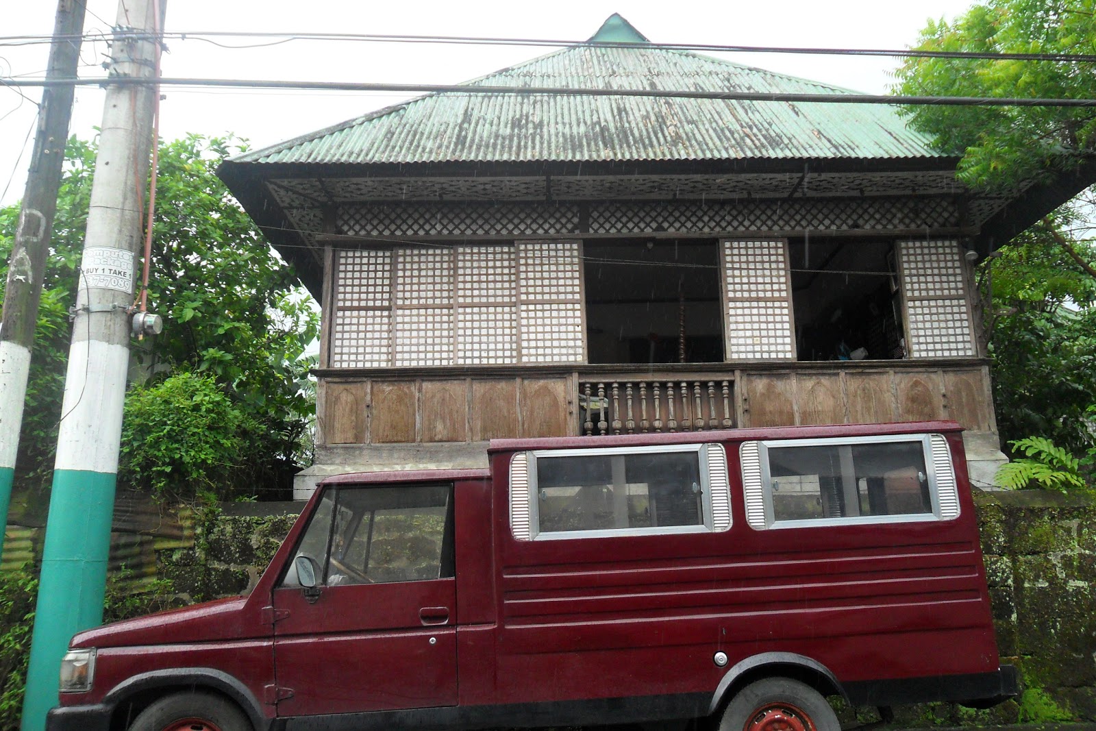
Riego de Dios Ancestral House – an old structure, reminiscent of the house during the Spanish period. This house belongs to the illustrious Riego de Dios clan of Maragondon. Famous members of which were Emiliano and Mariano Riego de Dios. Emiliano became the secretary of War during the time of Andres Bonifacio and Aguinaldo. The house although privately occupied offers a glimpse of the family’s rich history and tradition. A marker in recognition of Emiliano Riego de Dios can be seen outside of the house. Location: Poblacion 2


NHI Marker
Don Vicente Somoza House – the house belongs to a wealthy Chinese mestizo who also assisted the Revolutionary Government of President Emilio Aguinaldo, Don Vicente Somoza is a son of Maragondon. His two-storey house located across the town plaza and adjacent to Our Lady of the Assumption Parish Church. Privately owned.
This is one of the few remaining old structures within the town. In history Somoza is better known as one of the founders of the Filipino Chamber of Commerce and representative of Mati (Davao) in the Malolos Congress.


Punzalan House – a two-storey American colonial house with splendid details.


Dolorfino House – a two-storey old house with authentic pieces of family heirlooms. Privately owned. Caingin.

Mt. Pico de Loro–
It is located at the boundaries of Barangay Sta. Mercedes (Patungan) and Nasugbu, Batangas.


Mt. Buntis– it symbolizes the pregnant body of the sleeping beauty. In history, General Aguinaldo and his revolutionary government started their two and a half months of barefoot travel going to Biak na Bato (centennial trial). Located at Barangay Pinagsanhan-B.

Mt. Palay-Palay and Mt. Mataas na Gulod – the long hair of the sleeping beauty.
Mt. Tala and Mt. Palpag – the breasts of the sleeping beauty.
Mt. Tala and Mt. Palpag – the breasts of the sleeping beauty.
Mt. Hagdang Bato – the legs of the sleeping beauty.

Mt. Talipusa– the feet of the sleeping beauty.
Under the NIPAS law, the mountains of Mt. Palay-palay and Mt. Mataas na Gulod, a protected landscape was proclaimed as such in 1976 as National Park and it became a Protected Landscape on 2007.
The forest park is located southwest of Manila and bounded on the north by Puerto Azul and the Calumpang Point Philippine Naval Reservation; on the south by timberland; on the east by alienable and disposable lands; and on the west by China Sea. Mt. Palay-palay is 648 meters above sea level. It is predominantly timberland. Vegetative cover is estimated at 62.5% forest and 37.5% non-forest. It has rich varied flora and fauna species.


Waterfalls and Creek at Barangay Santa Mercedes
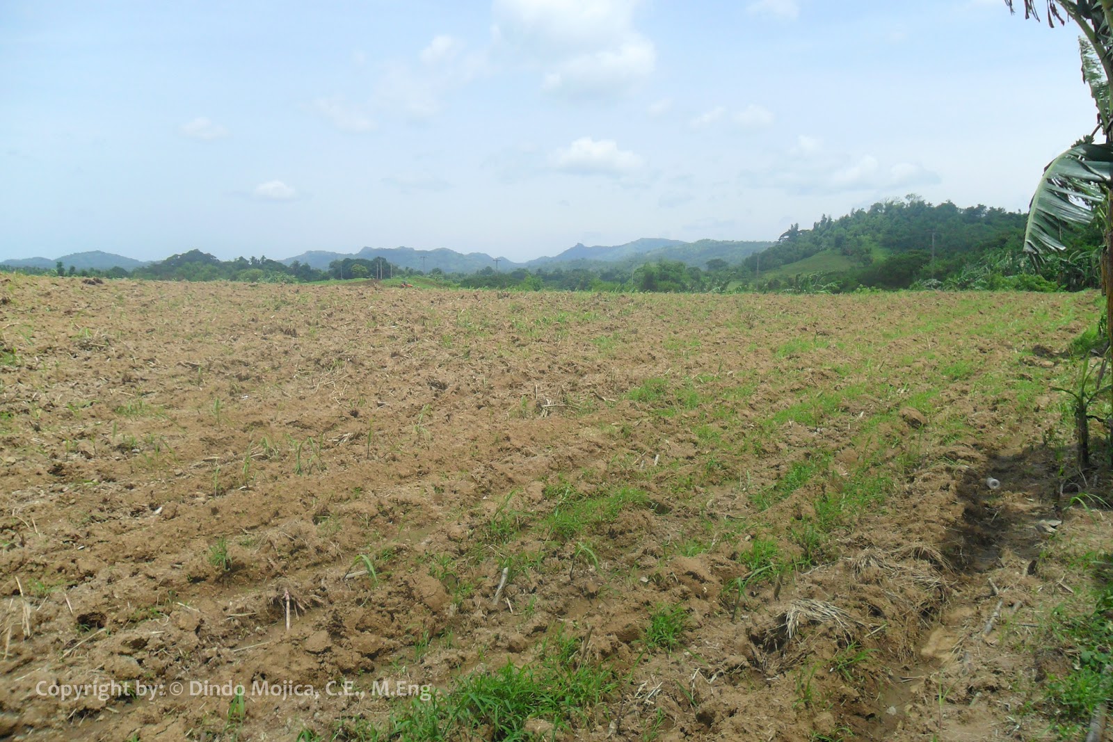
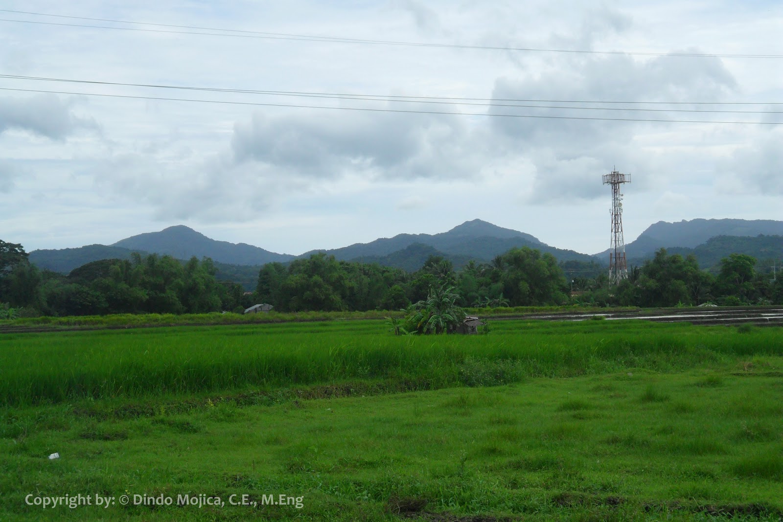
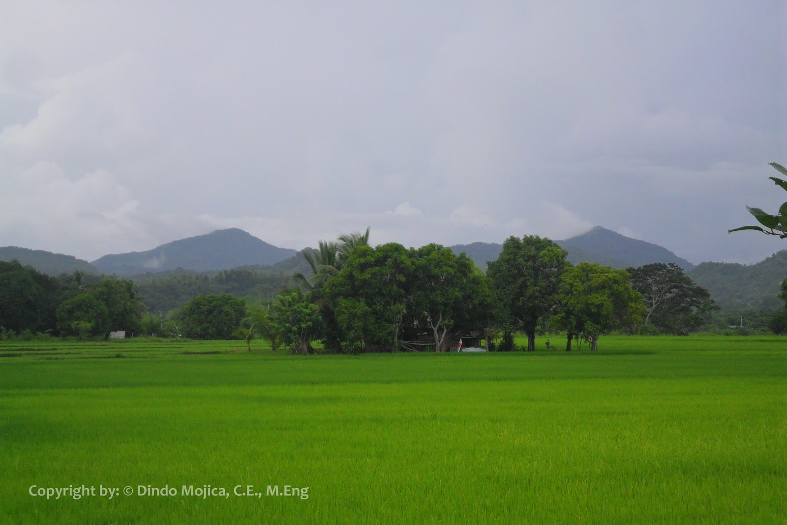
THE MOUNTAIN RANGES OF MARAGONDON

As viewed in Barangay Malainen Luma, Naic, Cavite

As viewed in Barangay Pantihan 1, Maragondon

As viewed in Barangay Pantihan 2, Maragondon

As viewed in Barangay Talipusngo, Maragondon
As viewed in Barangay Talipusngo, Maragondon

As viewed in Barangay Layong Mabilog, Maragondon

As viewed in Barangay Layong Mabilog, Maragondon

As viewed in Barangay Mabato, Maragondon

As viewed in Barangay Tulay-A (Mabacao), Maragondon

As viewed in Alfonso and Tagaytay City
As viewed in Garita-B, Maragondon
As viewed in Poblacion, Ternate, Cavite

As viewed in Tanza, Cavite

Mt. Pico de Loro, as viewed in Santa Mercedes, Maragondon

As viewed in Sta. Mercedes (Patungan), Maragondon (via Manila Bay)

As viewed in Pinagsanhan-B, Maragondon
MARAGONDON RIVER
MARAGONDON RIVER – the fourth longest river system in Cavite. Marvel at those very interesting rock formations as you spend the day in those cottages for hire, especially in the beginning of the summer season. Highly-recommended for picnics. (Bucal 3 and Tulay-A)

(As seen in Mabacao Bridge)

Maragondon River in Tulay-A and Bucal 3


Some Rock formations

Pinagsanhan Hanging Bridge


Caingin Hanging Bridge with Floating Balsa
You may also visit my blog post about Maragondon River: http://dincechronicles.blogspot.com/2013/09/maragondon-river.html
Areas for tourism in Maragondon’s municipal waters are the islets of Carabao and Limbones. The panoramic views and the blue waters of the South China Sea can be inspired by someone. Those areas are suitable for snorkelling, scuba diving, aqua culture, fish breeding and other water activities. These two islets can be developed into a world class tourist spot and research/training island resort.
Beaches of Sta. Mercedes – facing the South China Sea, the blue waters of Sta. Mercedes is a lovely little paradise away from the hustle and bustle of city life.


Carabao Island (Fort Frank) – one of the last frontiers of Cavite. It offers splendid view of the coastlines of Cavite Province.
.jpg)


Limbones Cove– a sitio of Sta. Mercedes. This place is a haven for tropical corals and fishes. Although still being disputed by the town of Maragondon in Cavite and Nasugbu in Batangas, historical documents prove that it rightfully belongs to the former town. Excellent for snorkelling and nature tripping.

MARAGONDON TOWN PLAZA
The municipalities in the Philippines, including Maragondon, that were established way back in the early days of Spanish rule were all patterned after the "Spanish-Portuguese Complex". The complex was a scheme devised by a decree given out by Spanish authorities of the time creating a uniform layout for all municipal government centers, with the town hall and the Catholic church facing one another across the community park, called the plaza.
This was done to more easily facilitate the activities of the church and state which were, at the time, one. The plaza became the venue for all official and religious activities and the assembly point for cultural functions.
To this day, the Maragondon Town Plaza has remained the hub of activity in the municipality and continues to be a major link in community building.

former Municipal Plaza Complex (2009)

(2011)

(2012)

developed/improved Municipal Plaza Complex (2013)

Riego de Dios brothers monument

Riego de Dios brothers monument

The newly-renovated Riego de Dios brothers monument

The newly-renovated Riego de Dios brothers monument

The newly-renovated Municipal Hall (as of October 2013)

The municipal plaza as viewed in the municipal hall

The municipal plaza as viewed in the municipal covered court

Mini-WaterFalls

Mini-Fountain

Solar Lighting Facility
OTHER INTERESTS:

A native pig (in upland barangays)

One of the bamboo handicrafts

Bamboo, the abundant product in Maragondon

Kaybiang Tunnel
(watch out for my blog post about the tunnel)

Lolo Claro's Restaurant
Famous for their fried chicken delicacies
Famous for their fried chicken delicacies
Highly-recommended place to dine-in
Links:
https://www.facebook.com/loloclaros
https://www.facebook.com/pages/Lolo-Claros-Restaurant/241641465894681
Links:
https://www.facebook.com/loloclaros
https://www.facebook.com/pages/Lolo-Claros-Restaurant/241641465894681
For more information, you may contact:
Maragondon Municipal Tourism Council
Telefax (046) 412-0590/ (046) 412-1872
or visit the new website of the Municipality of Maragondon - http://www.maragondon.cavite.gov.ph (as of October 2013)
Source:
Maragondon LGU Citizen’s Charter 2009
Brochure of Local Tourism Council of Maragondon (2009)
Old website of the Municipality of Maragondon - http://www.maragondon.gov.ph
Old website of the Municipality of Maragondon - http://www.maragondon.gov.ph
No comments:
Post a Comment